Friday, July 24, 2020 – Savanna Portage State Park, MN
Our campsite at Savanna Portage was near a lake. We weren’t on the lake, but it was only a few campsites away. I woke up with first light (as usual), so I went down to the lake to watch the sunrise. The campground was on the west side of the lake and watching the sun rise over the water was so beautiful and peaceful. A perfect start to the day. There was a woman alone on the dock when I arrived, so I sat on a bench on the shore to not disturb her. She left before me and as she walked by I noticed she was a teenager. For some reason she made me think of Delaney and how she always noticed and appreciated natural beauty, even as a kid, and how she would be one to get up to see the sunrise.

As I was watching the sunrise, trying to meditate and fighting thoughts of work I couldn’t help but think about water. This trip was all about water. Starting at home near the shore of Lake Michigan, across the Mississippi and Missouri Rivers, to the arid Badlands, the Black Hills, the grasslands, the canyons of The Little Missouri, and the lakes of Minnesota – everyplace has been shaped by water. Water’s abundance or scarcity affected erosion, vegetation, animal life, and human history everywhere we went. So I couldn’t help thinking about work. It is very rewarding and fulfilling to work in the water industry.
Once the sun was fully up we went for a nice long walk through the woods and to three lakes. I forgot my GPS watch so I don’t know the exact distance, but from the map it was somewhere between 5 and 6 miles. The temperature was great and the trails were very wooded and shady. The only problem was the mosquitoes and other bugs. As the day went on and got warmer and sunnier they thinned out, but we still got good use out of our repellent.
The first trail we hiked was the Continental Divide Trail. The trail follows the divide between the St. Louis River basin, which empties into Lake Superior at Duluth where the water finds its way to the St. Lawrence River and the Atlantic Ocean, and the Mississippi River, the route to the Gulf of Mexico. I pondered as I walked how much that divide has been a part of my life. It starts at an unidentified point somewhere deep in the Everglades where the river of grass flows indiscriminately into both the Atlantic and the Gulf. It follows the Florida ridge through the peninsula and more or less made up the eastern boundary of my sales territory for many years. It crosses into Georgia where it eventually follows the Appalachian Mountains, passing within a few miles of our cabin in Warrensville, NC. The New River at the base of the hill by the cabin flows to the Ohio River Basin, which flows to the Mississippi and the Gulf and just on the other side of the Blue Ridge Parkway water flows across North Carolina and to the Atlantic. The divide continues along the Appalachians to New York, where it turns west and goes around the Great Lakes passing through Waukesha County, Wisconsin, not 20 miles from where we live now. And on this day I found myself walking along the divide in central Minnesota. The mind definitely wanders while hiking and this wander was a good one.

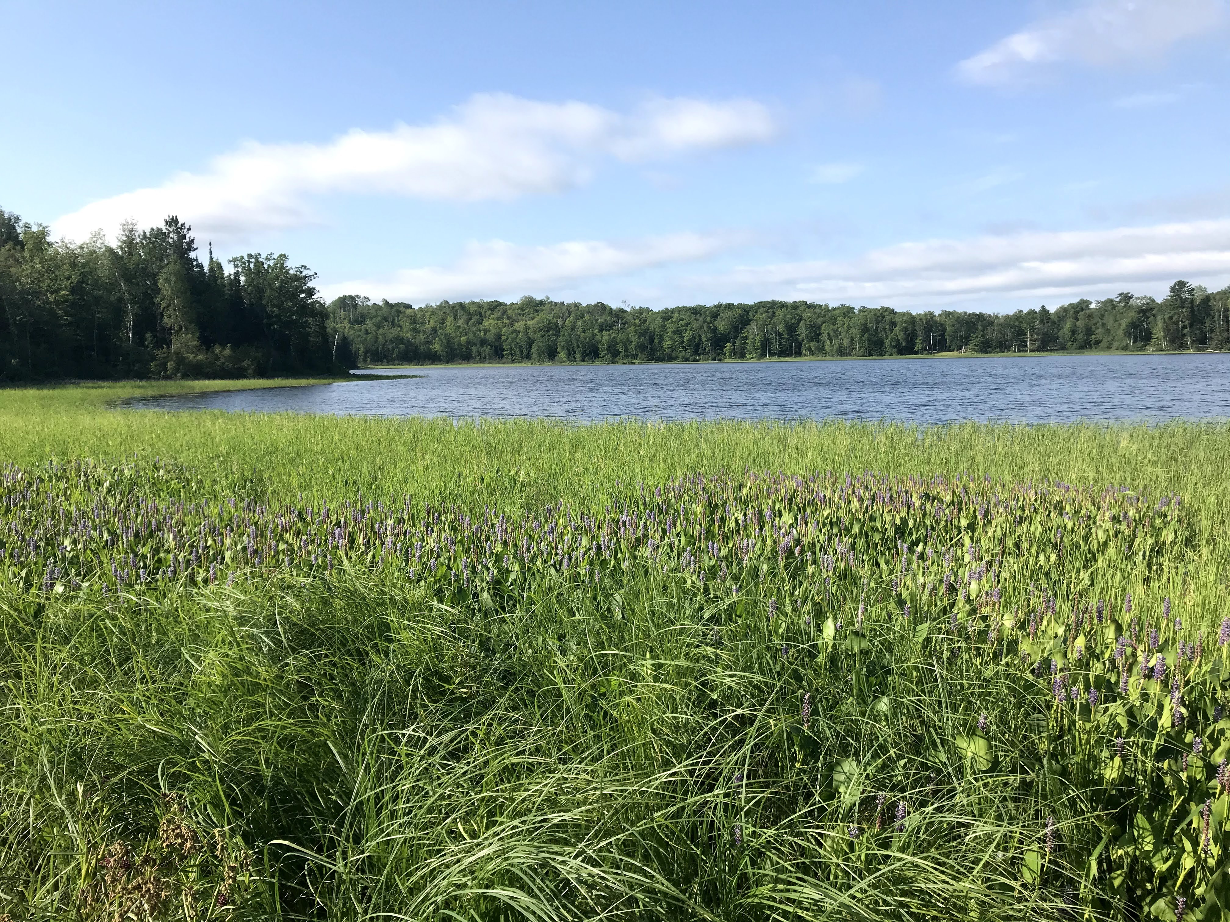
The Continental Divide Trail led us to a park road which we used to access two lakes. The lakes were gorgeous and quiet, but we didn’t see any wildlife. There are supposedly moose around Savanna Portage, but we know from previous experience that moose are nearly as elusive as Peter Matthiessen’s snow leopard. I think I am as content with not seeing a moose as Matthiessen was with not seeing a snow leopard, but I’m not so sure about Chrissy the moose-lover.
After visiting the lakes we hiked the Savanna Portage Trail back to the campground. Today’s hiking trail is the portage trail that was used for centuries by Native Americans for passage between the Mississippi and St. Louis Rivers. It is one of the shortest connection points between the Great Lakes and Mississippi basins and was used by natives long before it was “discovered” by fur traders. Aaron and I learned a lot about fur traders on our Northern Tier trip when he was in scouts. Fur trading was a big business in this area and in Canada. This was perhaps the oldest hiking trail I have ever walked. It was humbling to think of the thousands of people who walked this trail before me to hunt, to migrate, to trade, to survive. And here I was walking it for fun.
After hiking we ate PB&Js, sat in the shade by the lake, and took a nap. At one point I told Chrissy that I was the most relaxed I had been since the day with the naked guy on the clothing-optional red sand beach in Hana, Hawaii (you’ll have to wait for the 2019 Hawaii trip blog for that story). We had steaks over the fire for dinner and as the night wore on it got more and more humid and buggy. We retired to the tent pretty early, wrapping up a great trip.

I have certainly enjoyed going on this camping trip with you via your posts, thank you for sharing your adventures!!
LikeLike
They say you learn something new every day and reading your blog, this is true! I had to look up a continental divide map to visualize your description. I only really knew about the Great Continental Divide in the western US. I knew there was a ridge in Florida and of course the Appalachian Mountains, but didn’t realize (or think about) that being a divide for water run off. I guess I just don’t think of water the same way you do! But I loved learning about it and you better believe I will share my knowledge with my family! Please go on another trip soon so I can learn more!
LikeLiked by 1 person